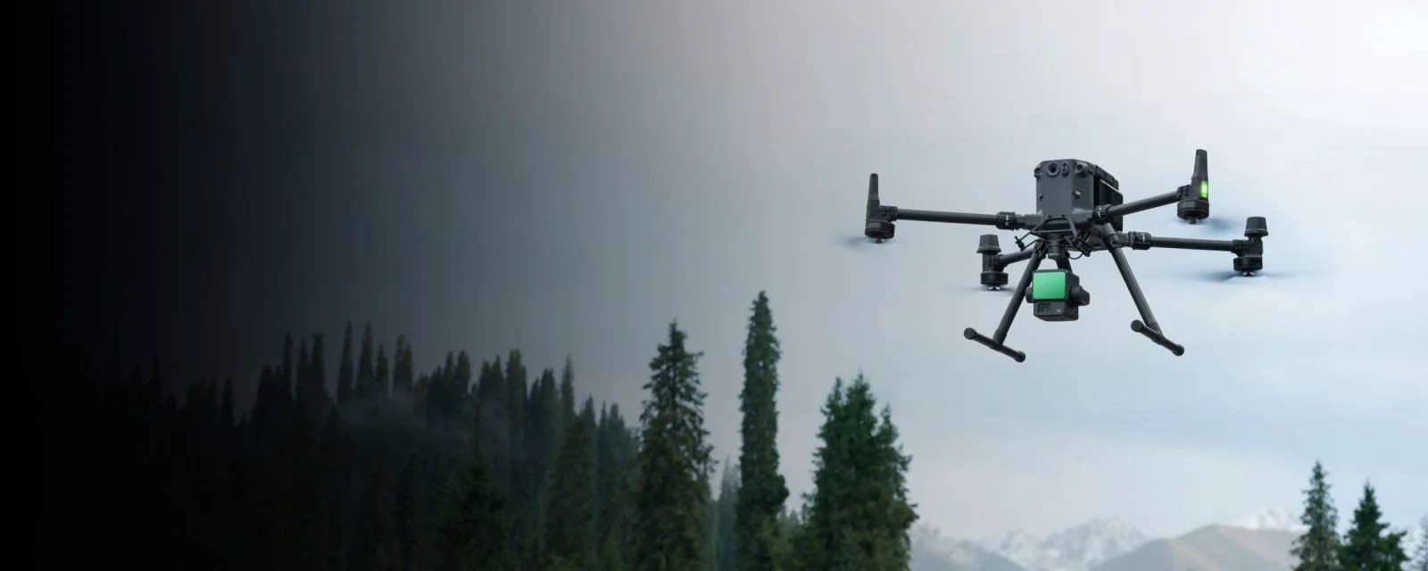
The New DJI Zenmuse L3 LiDAR Hybrid Sensor is a game changer …
LiDAR Solutions
Advanced light detection and ranging (LiDAR) land surveys offer numerous advantages over other techniques.
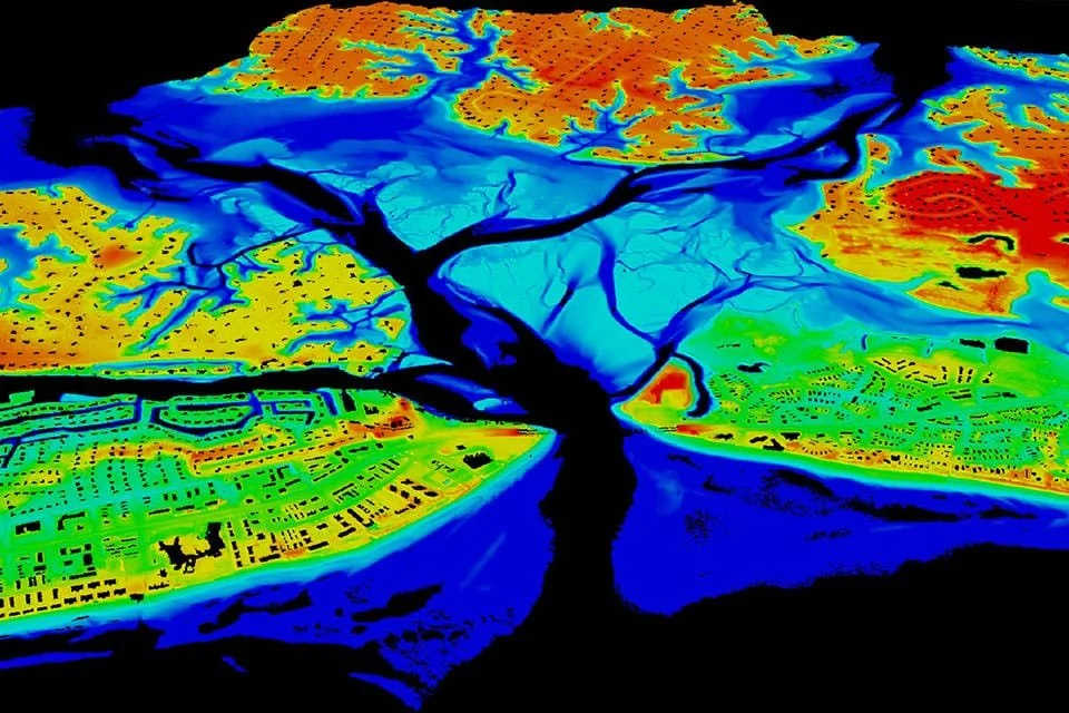
Laser scanning, a technology commonly known as LIDAR, offers a range of advantages over other surveying methods. It provides extremely precise control and visualisation through dense point clouds. With the advancement of drone technology, LiDAR enables laser pulses to penetrate dense vegetation, reaching the ground surface. This technology excels in terrain modelling, thrives in low-light conditions, and stands out as a superior alternative to photogrammetry. While photogrammetry can generate a reconstructed digital surface model (DSM), LiDAR alone can deliver accurate and survey-grade DSMs and digital terrain models (DSM).
Our integration of Unmanned Aerial Systems (UAS) with LiDAR empowers us to provide highly accurate terrestrial surveying, land surveying, and topographical mapping services. Laser scanning proves particularly advantageous for easement assessments and land surveying, as it offers the fastest and most cost-effective way to survey challenging terrain. We can deliver terrain data in various practical formats, including LAS/LAZ laser point clouds, 3D models, DXF/DWG vector files, ground contours, TIN, and more.the ground surface. This technology is ideal for terrain modelling, works perfectly in low-light conditions, and offers a distinct advantage over photogrammetry. While photogrammetry can deliver a reconstructed digital surface model (DSM), only LiDAR can deliver accurate and survey-grade DSMs and digital terrain models (DSM).
Our use of UAS (unmanned aerial systems) with LiDAR enables highly accurate terrestrial surveying, land surveying, and topographical mapping among other services. Ideal for easement assessments or land surveying, laser scanning is the fastest and most affordable way to survey difficult terrain. We can deliver terrain data in a number of practical formats, including LAS/LAZ laser point clouds, 3D models, DXF/DWG vector files, ground contours, TIN, etc.
LiDAR | MINING
LiDAR technology is revolutionising mining operations, enhancing inspection, surveying, and mapping efficiency and safety.
In mining, LiDAR-equipped drones are employed to inspect mines after planned detonations, ensuring the safety of the area before sending in human workers. These drones also measure ore volumes and extraction spaces.
Underground mining environments render GPS operations impossible for drones, making LiDAR and visual sensors crucial for their operation without GPS.
BENEFITS OF LIDAR DRONES IN MINING
Increased ore extraction: 3D maps created using LiDAR data can identify potential remaining ore, leading to substantial additional revenue for mining companies.
Planning: LiDAR drones, in conjunction with ground-based scanners, can compare new surface data with previous scans to determine areas rich in resources or requiring targeted attention.
Safety: Mapping unstable areas allows for their evaluation for safety.
Savings: Improved understanding of crucial excavations in mines can lead to increased ore extraction and enhanced overall efficiency, resulting in substantial potential savings. excavations in a mine can lead to more ore extraction and greater efficiency overall, leading to huge potential savings.
LiDAR | GIS
Ready to elevate your aerial mapping capabilities? Lidar technology is revolutionizing how we understand and interact with our world, offering unparalleled advantages over conventional methods.
Imagine acquiring highly accurate spatial data with remarkable speed. Lidar delivers just that, providing surface information with an exceptional level of detail that unlocks new possibilities for critical applications.
From precise forest inventory and comprehensive floodplain mapping to in-depth hydrological and geomorphological analysis, lidar is the game-changer. Envision detailed urban planning, insightful landscape ecology studies, robust coastal engineering solutions, streamlined survey assessments, and accurate volumetric calculations – all empowered by the rich datasets lidar provides.
The synergy of lidar and GIS takes these applications even further, enabling seamless analysis, efficient management, compelling visualization, and effortless dissemination of this invaluable data.
Consider these key differentiators:
Unmatched Speed and Accuracy: Acquire data rapidly without compromising on precision.
Superior Data Density: Achieve higher sample density, leading to significantly improved results, particularly in complex scenarios like floodplain delineation.
Penetrating Insights: Obtain accurate terrain data even in dense forest environments where traditional photogrammetry falls short due to canopy obstruction.
24/7 Operational Flexibility: Leverage lidar's active illumination to collect data day or night, overcoming the limitations of passive photogrammetric techniques.
Geometric Integrity: Rely on data free from the inherent geometric distortions found in side-looking radar.
Seamless Integration: Enhance your existing workflows by effortlessly combining lidar with other valuable data sources.
Isn't it time you harnessed the transformative power of lidar to gain a decisive advantage in your field? Let's explore how this cutting-edge technology can redefine your approach to spatial data acquisition and analysis.
LiDAR | BUILT ENVIRO
Elevate Your Projects with Precision Lidar Solutions
Imagine having a crystal-clear, comprehensive understanding of your project site from the outset. With lidar technology, that vision becomes reality.
1. Revolutionizing Site Surveying and Mapping:
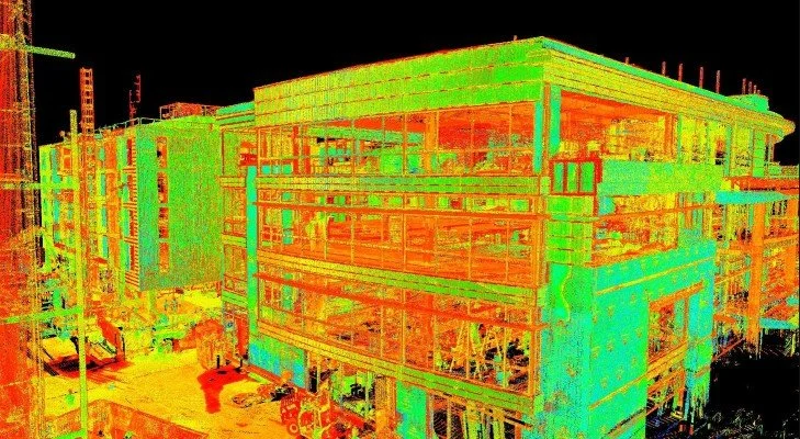
Unlock Unparalleled Detail with 3D Modeling: Gain access to incredibly accurate 3D models that capture every nuance of the terrain, existing structures, and vital infrastructure. This granular detail is the bedrock of informed planning and design, minimizing surprises and maximizing efficiency.
Experience Rapid and Reliable Topographic Mapping: Say goodbye to time-consuming traditional surveys. Lidar delivers swift and precise topographic data for urban environments, empowering urban planners and engineers with the essential insights needed to optimize land use and infrastructure development.
Establish a Solid Foundation with As-Built Documentation: Capture the definitive "as-built" state of your site with lidar's precision. This invaluable record serves as an accurate baseline for all future endeavors, from expansions to renovations.
2. Transforming Construction and Renovation Planning:
Design with Unprecedented Insight: Leverage detailed 3D models to achieve a deeper understanding of the terrain and existing structures. This leads to smarter, more efficient designs that seamlessly integrate with the environment, saving time and resources.
Optimize Resources with Precise Material Estimation: Eliminate guesswork and waste. Lidar data enables highly accurate calculations of material requirements, directly impacting your bottom line and promoting sustainable practices.
Proactive Problem Solving through Conflict Detection: Identify potential clashes and constructability issues early in the planning phase by comparing lidar data with proposed designs. This foresight prevents costly delays and rework.
Preserve the Past with Detailed Historical Structure Analysis: Capture the intricate details of historical structures with non-invasive lidar surveys. This invaluable data is essential for accurate restoration and preservation efforts.
3. Ensuring Proactive Monitoring and Maintenance:
Gain Actionable Insights into Structural Health: Continuously monitor the condition of structures with lidar, proactively identifying potential deformation or collapse risks. This early detection allows for timely interventions, ensuring safety and preventing costly failures.
Maintain Project Momentum with Precise Progress Tracking: Keep your construction projects on schedule and within budget with lidar-based progress monitoring. Objective data provides clear visibility into project milestones and potential delays.
Prioritize Safety with Hazard Identification: Enhance construction site safety by utilizing lidar to identify potential hazards and ensure a secure working environment for all personnel.
Ready to experience the transformative power of lidar for your next project? Let's discuss how our tailored lidar solutions can provide you with the precise data and actionable insights you need to succeed.
LiDAR | CIVIL
Lidar is indeed a game-changer in civil engineering, offering a powerful suite of applications that drive efficiency, accuracy, and safety. Let's refine those points into compelling benefits for civil engineering professionals:
Unlock Unprecedented Precision and Efficiency in Your Civil Engineering Projects with Lidar
Imagine having the power to capture the intricate details of your project site and infrastructure with unparalleled accuracy and speed. Lidar technology delivers just that, revolutionizing how civil engineers approach surveying, mapping, monitoring, and management.
1. Revolutionizing Surveying and Mapping:
Generate Highly Accurate Digital Terrain Models (DEMs) and Topographic Maps: Lay the foundation for successful infrastructure design, land development, and environmental analysis with precise and detailed terrain data. Lidar empowers you to create the essential groundwork for informed decision-making.
Capture the Definitive "As-Built" Condition: Ensure accurate project management and a comprehensive understanding of existing infrastructure with detailed lidar scans that document the precise "as-built" state. This invaluable information streamlines future modifications and maintenance.
Navigate Complex Terrain with Confidence: Identify and map even subtle imperfections in the terrain with lidar's high-resolution data. This critical insight is essential for the effective planning and design of vital infrastructure like roads and railways, minimizing potential challenges and optimizing construction.
2. Proactive Infrastructure Monitoring:
Gain Actionable Insights into Infrastructure Health: Proactively assess the condition of critical infrastructure – bridges, dams, roads, and more – by detecting even minor deformations, cracks, and structural abnormalities. Early identification of these issues enables timely maintenance and prevents costly failures.
Ensure Structural Integrity with Continuous Monitoring: Monitor the structural health of buildings and other key structures with lidar's precise measurements. This ongoing analysis helps identify potential problems in their earliest stages, safeguarding public safety and extending the lifespan of assets.
Rapid and Accurate Damage Assessment: In the event of unforeseen events like floods or earthquakes, lidar provides the ability to quickly and accurately assess the extent of the damage. This rapid data acquisition is crucial for efficient emergency response and effective recovery efforts.
The integration of lidar into civil engineering workflows isn't just an upgrade – it's a fundamental shift towards greater accuracy, enhanced efficiency, and improved safety. Are you ready to leverage the transformative power of lidar to elevate your civil engineering projects? Let's explore how our tailored lidar solutions can provide you with the precise data and actionable insights you need to build a better future.
About
our company
We are excited to announce our expanded LiDAR services, now featuring the DJI M350 RTK | M400 RTK Drone | DJI Zenmuse L2 and now the new L3 LiDAR Sensor. We are ready to provide comprehensive LiDAR solutions for your projects, including high-resolution point clouds, digital surface models, and orthomosaics. Our services are available for various applications, from surveying and mapping to asset inspections and 3D modeling. We are committed to delivering accurate and timely results to meet your specific needs.
Contact Us
Interested in how LiDAR Solutions can assist you with your next project? Please complete the contact form and we will have one of our team contact you to discuss you requirements.
You will also receive our complementary Guide To LiDAR.


